From Survey Fundamentals to Connected Construction

Hands-on learning in CVEN 2215: Surveying Data Collection and Surveying Lab

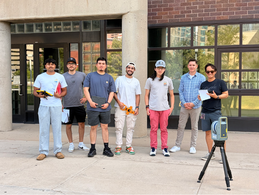
Summer 2026 CVEN 2215 students with the Trimble X9 terrestrial laser scanner on the Auraria Campus.
CVEN 2215, Surveying Data Collection and Surveying Lab, gives civil engineering students practical experience collecting, evaluating, and presenting spatial data. As the laboratory companion to CVEN 2214, Surveying for Engineering, the course connects principles such as elevation, orientation, coordinates, measurement error, and adjustment with the field procedures used in engineering and construction. The objective is not simply to teach students how to operate equipment, but to help them understand how measurements are produced, how their quality is evaluated, and how survey data support real engineering decisions.
Students begin with foundational surveying methods using automatic and digital levels and conventional total stations. These exercises introduce the importance of instrument setup, control, orientation, field notes, calculations, and measurement checks. During a level-loop exercise, students collect backsight and foresight observations, calculate elevations, close their survey on a known benchmark, and evaluate and adjust the resulting misclosure. The process makes it clear how small differences in field observations accumulate and why measurements must be checked rather than accepted without verification.
The same principles carry into total-station work, where students establish an instrument position, orient from known control, collect angular and distance measurements, calculate coordinates, and compare the results with recognizable site features. Beginning with these direct measurement and calculation methods gives students a basis for understanding what newer equipment automates and what responsibilities still remain with the person operating it.
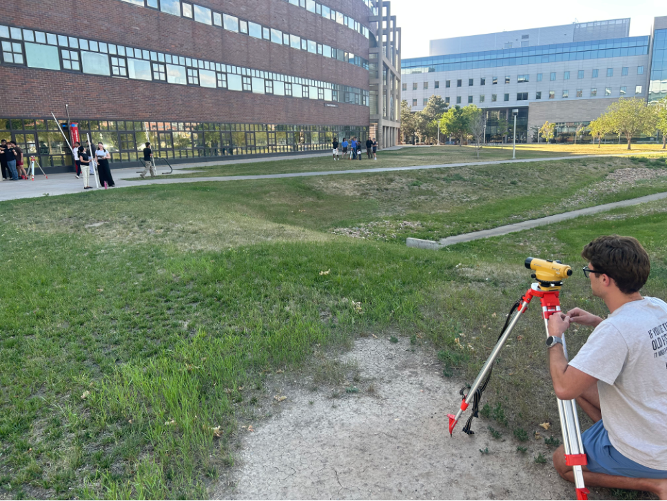
Students complete a level-loop exercise, connecting instrument setup and field observations with elevation calculations and closure checks.

From Field Measurements to Connected Project Control
From this foundation, the course follows a progression much like the broader development of construction surveying: moving toward digitized, automated, and increasingly connected systems for measurement, layout, documentation, and project control.
The Trimble S5 robotic total station is an important part of that progression. Although the compressed summer schedule did not allow time for the S5 workflow, it has been used in previous semesters with Trimble Access. Students are introduced not only to robotic measurement, but also to the larger process surrounding the instrument.
A modern survey project begins before the field crew arrives on site. Project information can be organized through Trimble Connect and brought into Trimble Access, where students review job settings, coordinate systems, units, survey styles, control points, and the information needed for fieldwork. At the site, those digital settings must be connected to physical project control. Students occupy or establish a known point, orient the instrument using a backsight, verify the setup, and collect or lay out points within the project coordinate system.
Working through this process shows how office planning, field measurements, and construction control fit together. Coordinate systems and control networks can be described in lecture, but completing a project and instrument setup demonstrates why an incorrect setting, unreliable control point, or poor backsight can affect everything collected afterward. Students can learn the rules for instrument setup, control, and data quality in lecture. Working directly with the equipment allows them to see why those rules exist, how field conditions affect the results, and when a measurement should be questioned or repeated.
Investigating GNSS Performance in the Field
The course then expands from individual measurements into GNSS mapping. Using the Trimble R12 receiver, Trimble Mobile Manager, and QField, students collect and map building corners, entrances, sidewalks, structures, and other features that would be useful in a site survey. They must decide which observations meaningfully describe the site rather than simply collecting a group of unrelated coordinates.
Students are tasked with investigating and reporting how surrounding conditions influence GNSS performance. Observations are collected in open areas, beside buildings, beneath vegetation, and near other obstructions. Students compare reported accuracy and satellite information, repeat selected observations, and explain why the results vary between locations.

This interpretation is central to the exercise. Practices such as maintaining a clear view of the sky, keeping the survey pole upright, allowing a solution to stabilize, and repeating important observations can be explained in the classroom. Seeing the displayed solution respond to buildings, vegetation, and changing field conditions makes the purpose of those practices more apparent. Students learn to connect the information reported by the receiver with the physical conditions surrounding each observation rather than treating every coordinate as equally reliable.
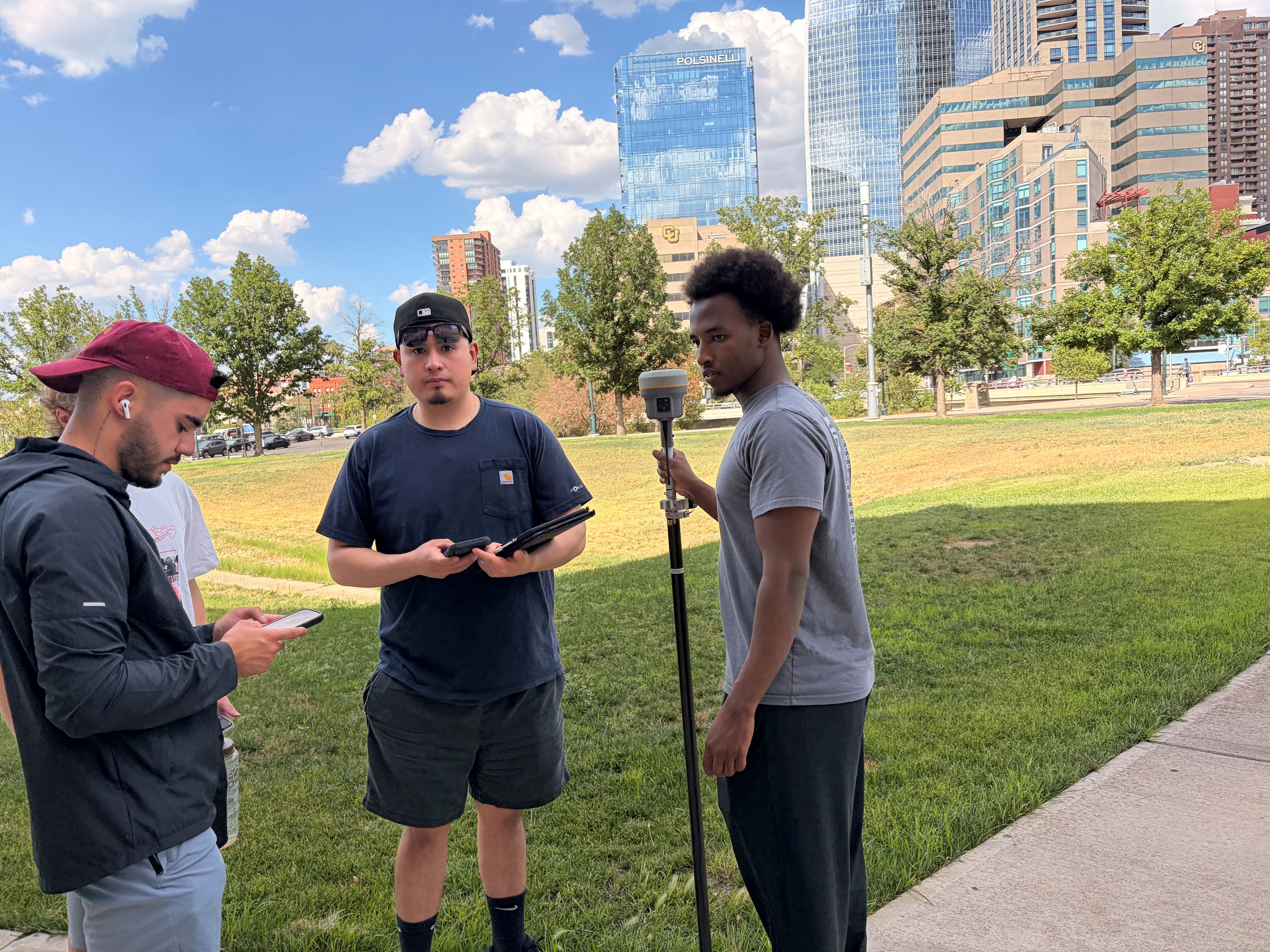

            Students collect and review GNSS observations with the Trimble R12.                  Trimble Mobile Manager allows students to review satellite availability while collecting data.

From Individual Points to Three-Dimensional Scenes

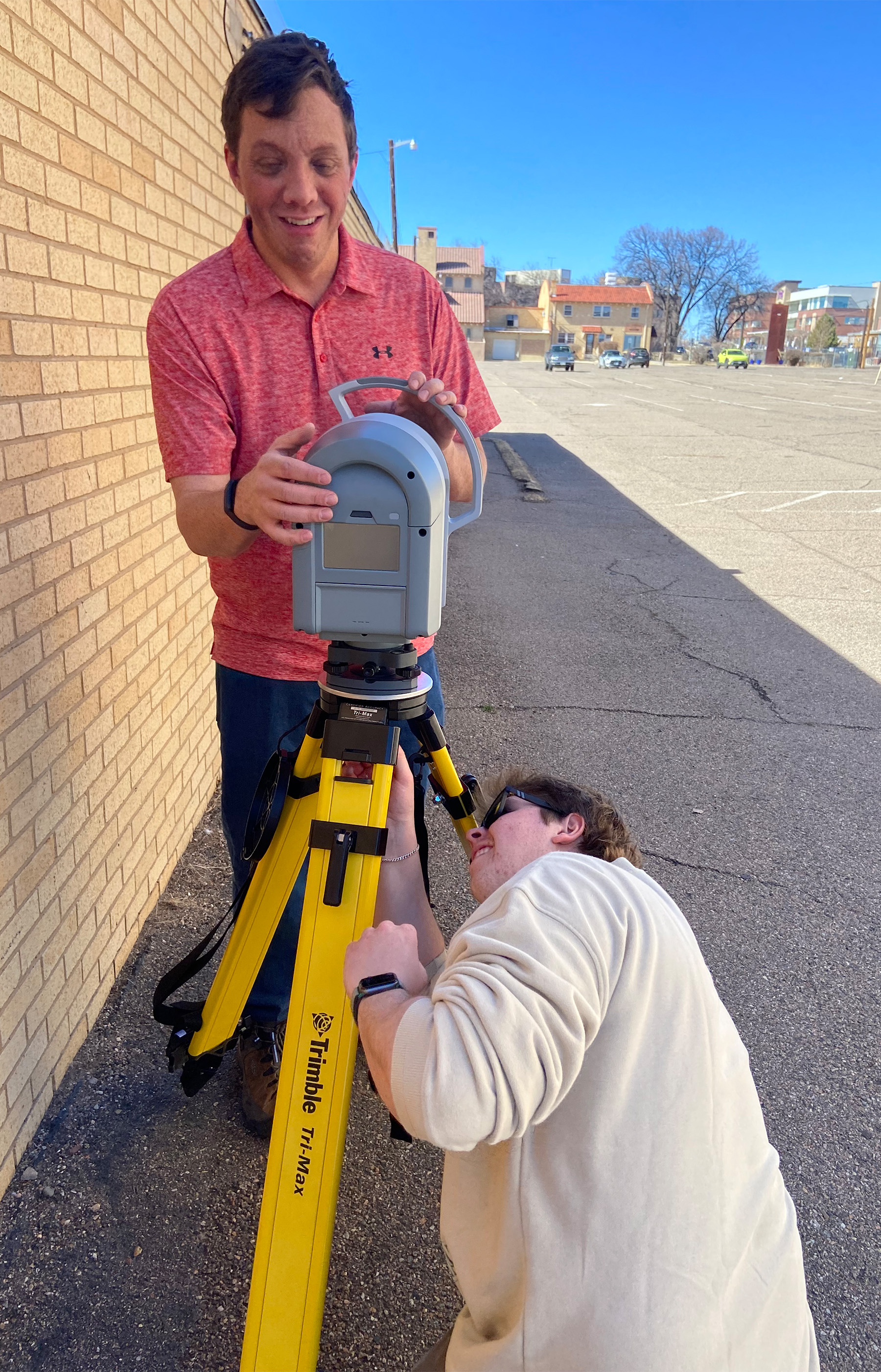
The Trimble X9 terrestrial laser scanner expands the scale of data collection further. Instead of observing selected points, students capture entire indoor and outdoor environments as three-dimensional point clouds and explore the results through Trimble Perspective.

The laboratory is structured as an investigation rather than a demonstration. Students compare scan durations, examine how detail changes with distance, and evaluate how buildings, pavement, glass, reflective surfaces, vegetation, and other features appear in the point cloud. Measurements made within the point cloud are compared with conventional tape measurements, connecting the newer technology back to a familiar method of verification.
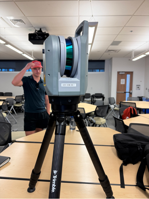
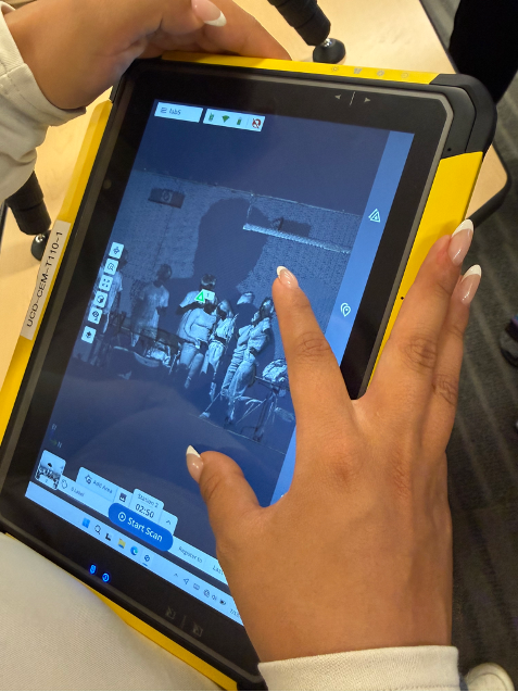
                Students set up the Trimble X9 for indoor and outdoor scanning exercises.              Point-cloud results are reviewed and measured in Trimble Perspective while still in the field.

Students also introduce moving people and objects into the scene and observe the gaps, streaks, duplicated objects, and other artifacts that may result. They are then asked to explain what they observed and consider when terrestrial laser scanning would be useful and when a conventional method may still be more appropriate.

Longer scans may produce denser results, but additional data do not automatically make every feature complete or reliable. Distance, movement, surface characteristics, and the intended use of the final product all influence whether a scan is suitable. Direct interaction with the scanner makes these limitations visible and gives students experience interpreting a dataset rather than simply being impressed by the visualization.
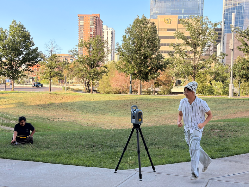
A moving-object investigation helps students observe how changes within a scene can create artifacts in a point cloud.

Preparing Students to Use and Evaluate Modern Survey Data

This hands-on experience is valuable even for students who do not plan to become professional surveyors. As engineers, construction managers, inspectors, and designers, they will rely on control points, layout information, as-built records, GIS data, and three-dimensional site models. Using the equipment helps them understand how those products were created, what conditions may have affected them, and what questions should be asked before the data are used for design or construction.
The progression from level loops to connected projects, robotic total stations, GNSS mapping, and terrestrial laser scanning gives students more than exposure to modern equipment. It allows them to experience why the underlying principles of control, measurement, verification, and professional judgment remain essential within increasingly automated construction workflows.
A valuable future addition would be the Trimble SX12 scanning total station. By combining robotic total-station measurement and three-dimensional scanning, it would create a direct connection between the S5 and X9 portions of the course. Students could collect discrete control or layout points and dense point-cloud data from the same setup, then compare which approach is most appropriate for different engineering applications.


Students Help Preserve East Portal Cabins

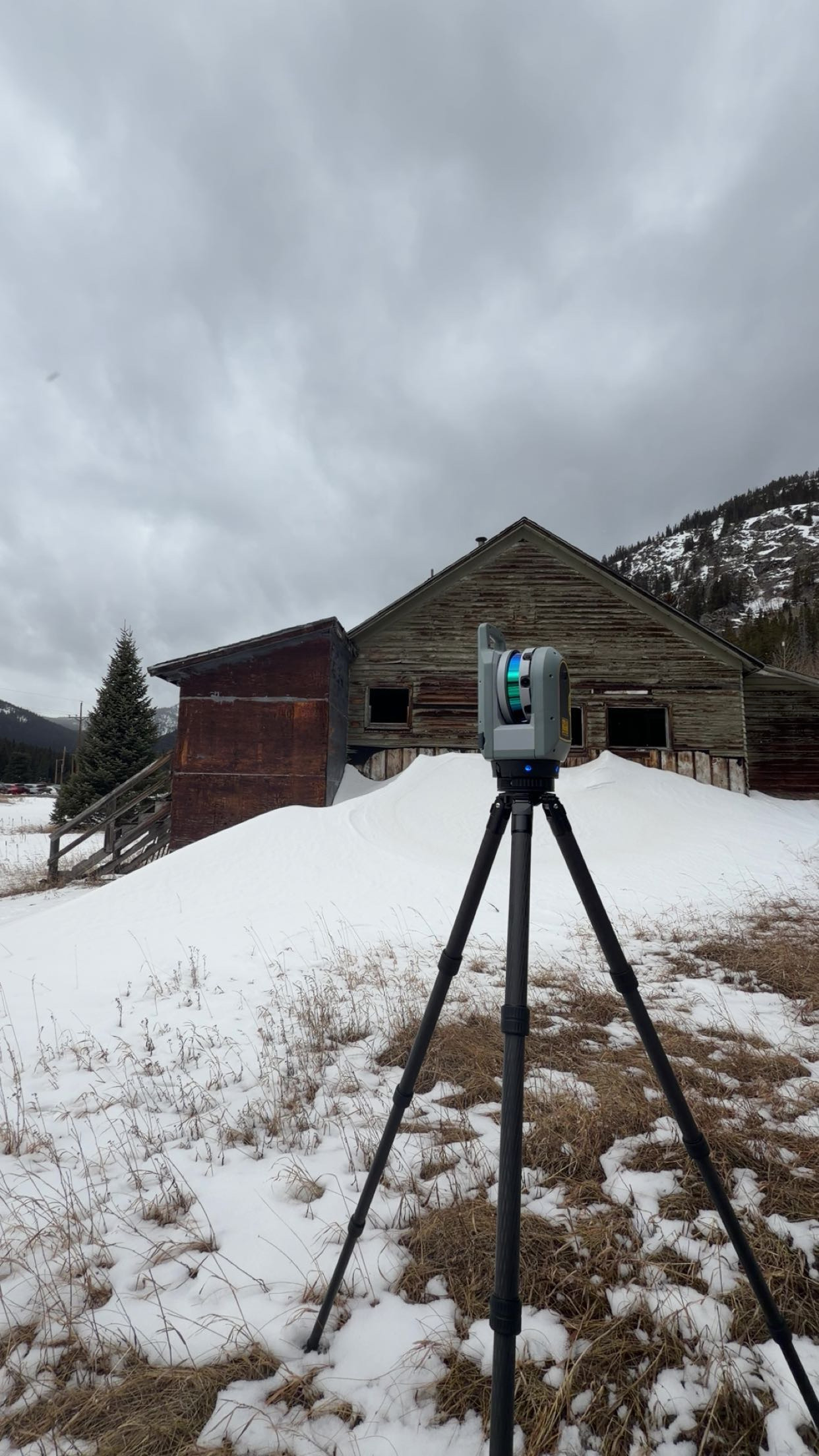
scanner

Another preservation effort in books. In the Spring of 2026, a group of CU Denver students travelled to Gilpin County, at the eastern entrance to the Moffat Tunnel, where the East Portal Camp Cabins have been located since 1922. This Historical village represents the vision of David H. Moffat and Clifford A. Betts, who intended for the town to be a stop along the rail connection between Denver and the West Coast. However, “the Moffat Tunnel ultimately shortened transcontinental routes by approximately 150 miles and permanently altered transportation across the Continental Divide.(“East Portal Camp Cabins - Colorado Preservation, Inc.”). Over 100 years later, six students from the CU Denver Department of Engineering and Construction utilized the Trimble technology tools available to them to assist Colorado Preservation Incorporated determine what of the remaining cabins can be salvaged and preserved.

The East Portal Cabins was originally a town designed as a self-sustaining community for the tunnel construction workers and their families. “Contractors Hitchcock and Tinkler implemented a deliberate “factory system” approach to workforce stability, designing a self-contained town that combined housing, workspaces, food access, medical care, and recreation to reduce labor turnover and improve safety and productivity. Under the direction of engineer Clifford A. Betts, the camp was organized along a central east-west axis extending from the tunnel portal, with industrial functions to the south, residential and social spaces to the north, and a distinct “Cottage Village” of eleven single-family homes reflecting contemporary residential design.(“East Portal Camp Cabins - Colorado Preservation, Inc.”). However, only 5 cabins on the East side of the tunnel remain, and nothing from the west side still stands. Colorado Preservation Inc. is committed to ensuring these cabins can be preserved and potentially restored to show the dedication and intense work environment people endured to build the tunnel that is still used today. “(The cabins) constitute the sole remaining built connection to the workers who constructed the tunnel and to the lives organized around that labor, preserving a rare physical record of the community that made the project possibleIn that sense, the cabins function as documentary evidence in built form, capturing aspects of the project that do not survive in engineering records alone.” (“East Portal Camp Cabins - Colorado Preservation, Inc.”)

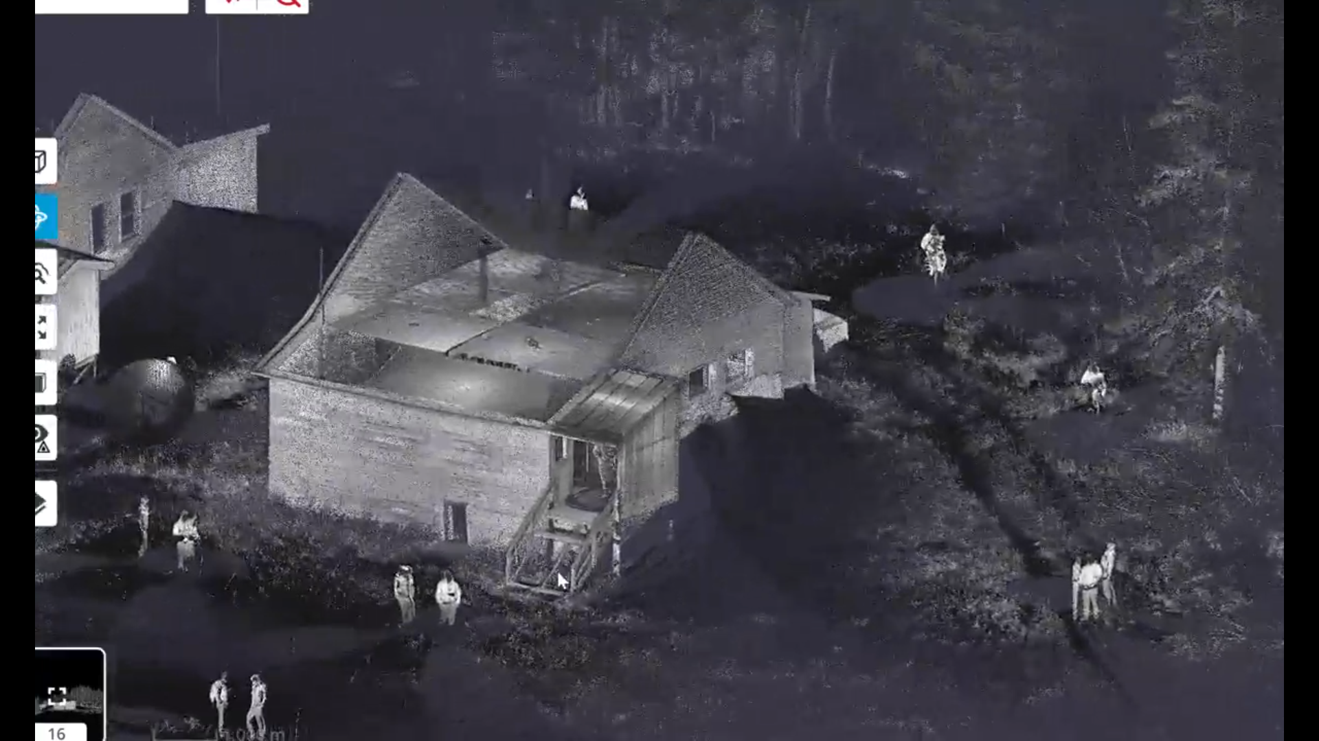
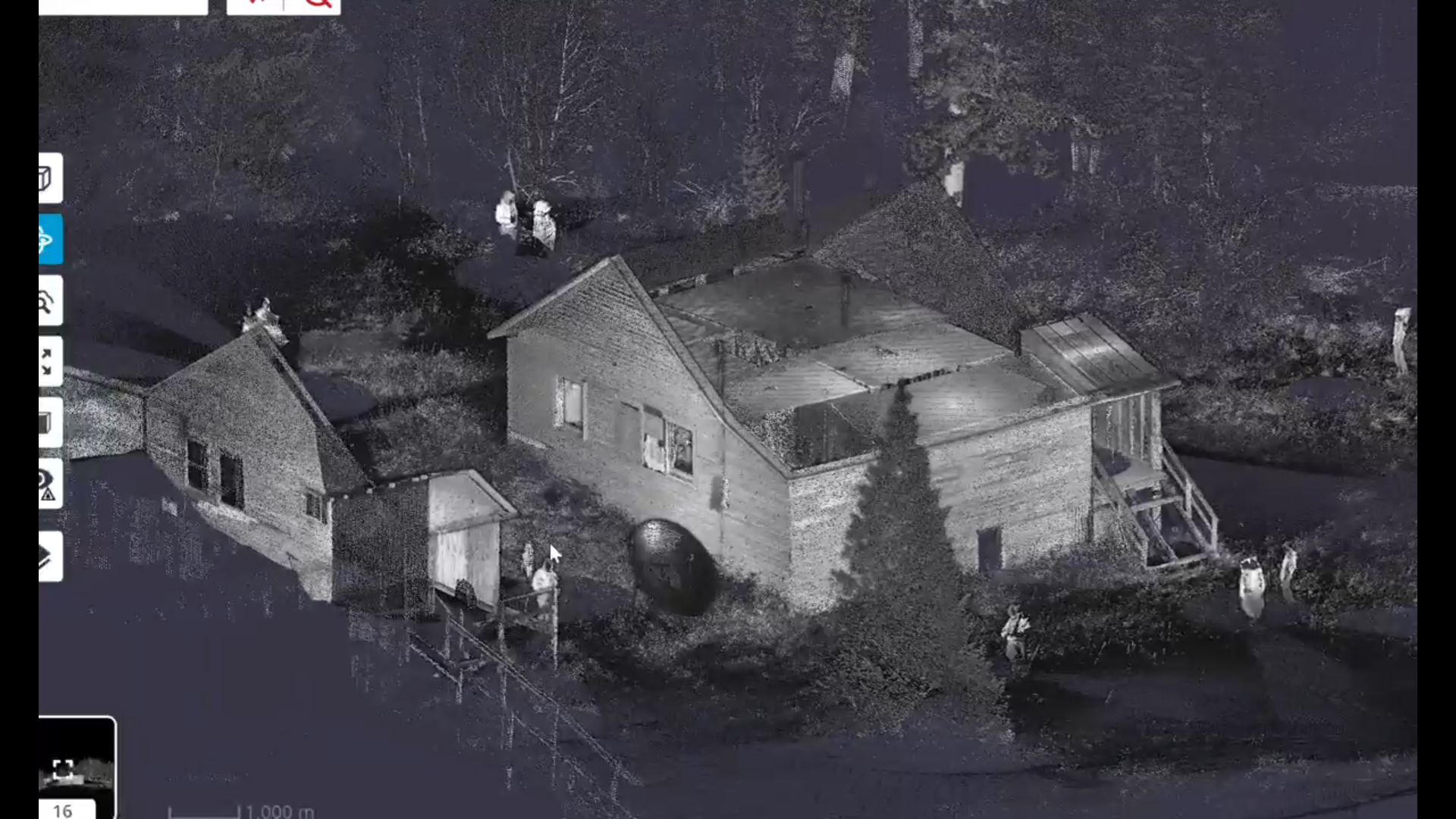
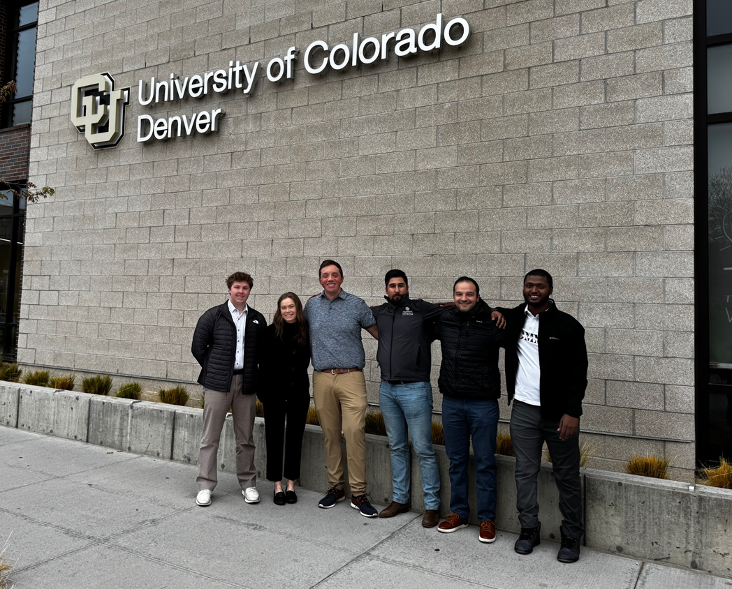
This is where the group of students comes in. Using a Trimble X9 Laser Scanner, students Mahdi Alattar, Zamira Chavez, Ali Alhabshi, Mohammed Aljedi, Hamad Boodai, and Abdulaziz Alshemali were able to gather 3D and laser scans of 3 of the remaining structures. Because of safety concerns, the students were not allowed to enter the buildings, so all scans were taken from outside. The group walked away with impressive visuals and a clear understanding of the building’s current condition.


scanned cloud points 1


scanned cloud points 2


“The technology was very easy to use,” said students Abdulaziz Alshemali and Hamad Boodai in an interview about the project. They shared how the scanners were versatile and helped them overcome major challenges related to safety and weather conditions. “It’s an amazing piece of technology,” said Boodai highlighting how they used the X9 to scan hard-to-reach places. Alshemali and Boodai explained how the project posed challenges for the Colorado Preservation Incorporation because the buildings are so old that no records of their dimensions survive. However, with these new scans, the organization now has a stronger idea of what to expect when considering preservation plans. Alshemali and Boodai hope that their team’s efforts will aid in transforming the cabins into useable, educational and historical attractions in the front range region. “As international students, it would be amazing to come back in the future with our families and see the impacts of our work,” said Boodai.

As of now, the cabins face many risks. “The structures face multiple threats from demolition by neglect, prolonged exposure to severe mountain conditions, wildfire risk, and vandalism.(“East Portal Camp Cabins - Colorado Preservation, Inc.”) The current owners, Union Pacific and Gilpin County, are working with Colorado Preservation Inc. to discuss options for the historical site. Fortunately, in 2023, the cabins were officially designated a Gilpin County Local Historic Landmark. However, this does not mean preservation efforts can begin. “Without a clear preservation pathway, the cabins will continue to lose historic fabric and interpretive value; with one, they could support a compatible adaptive reuse approach consistent with the Secretary of the Interior’s Standards, allowing the buildings to remain both historically legible and publicly meaningful.(“East Portal Camp Cabins - Colorado Preservation, Inc.”)

Works Cited

“East Portal Camp Cabins - Colorado Preservation, Inc.” Colorado Preservation, Inc., 2 Apr. 2026, www.coloradopreservation.org/endangered-place/east-portal-camp-cabins/. Accessed 27 May 2026.


EPIC Students Explore CU Denver’s TTL

EPIC High School Students Explore CU Denver’s Trimble Technology Lab

atlas belly side up

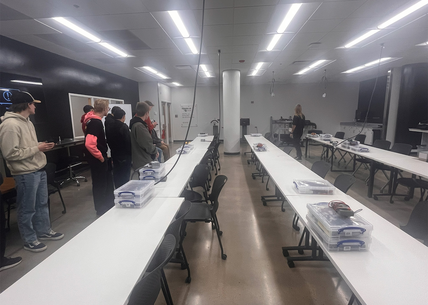
On December 12th, Trimble— in collaboration with CU Denver’s Department of Civil Engineering and Construction and the College of Engineering, Design, and Computing (CEDC)—proudly welcomed students from Colorado High School EPIC Campus for an immersive tour of the university’s Trimble Technology Lab. The visit was designed to introduce high school students to the tools, technologies, and career pathways shaping the future of the construction and engineering industries. 

The tour kicked off inside the main Trimble Technology Lab, where faculty, staff, and student volunteers showcased several advanced instruments used regularly by CU Denver students. Among the highlights were the TX8 Laser Scanner and S5 Total Station—precision tools used for surveying, data collection, and 3D modeling. Faculty and student presenters walked participants through the real-world applications of each tool, reflecting the department’s commitment to integrating hands-on, industry standard technology into the academic experience. 

presentation photo

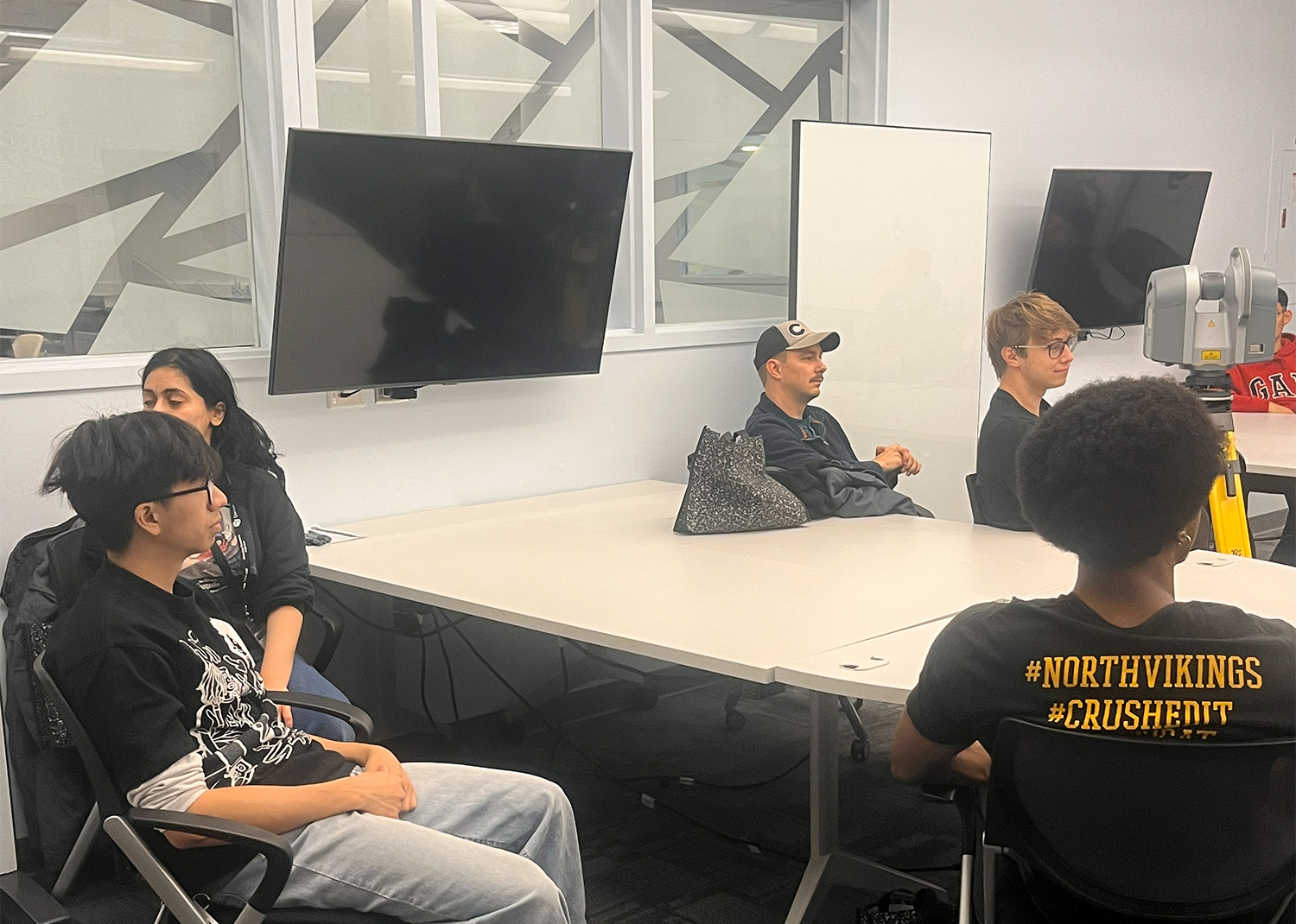
Beyond learning about equipment, EPIC students engaged in a Q&A session with CU Denver faculty and current Civil and Construction Engineering students. Conversations centered on academic pathways, day-to-day work in the construction field, and the wide range of roles available across the industry. Many of the visiting students expressed interest in military careers, sparking thoughtful discussions about the connections between military service and engineering disciplines, from opportunities within the armed forces to the transition into civilian engineering careers after service. These conversations provided valuable insight into how technical skills developed in both military and academic settings can support long-term professional success. 

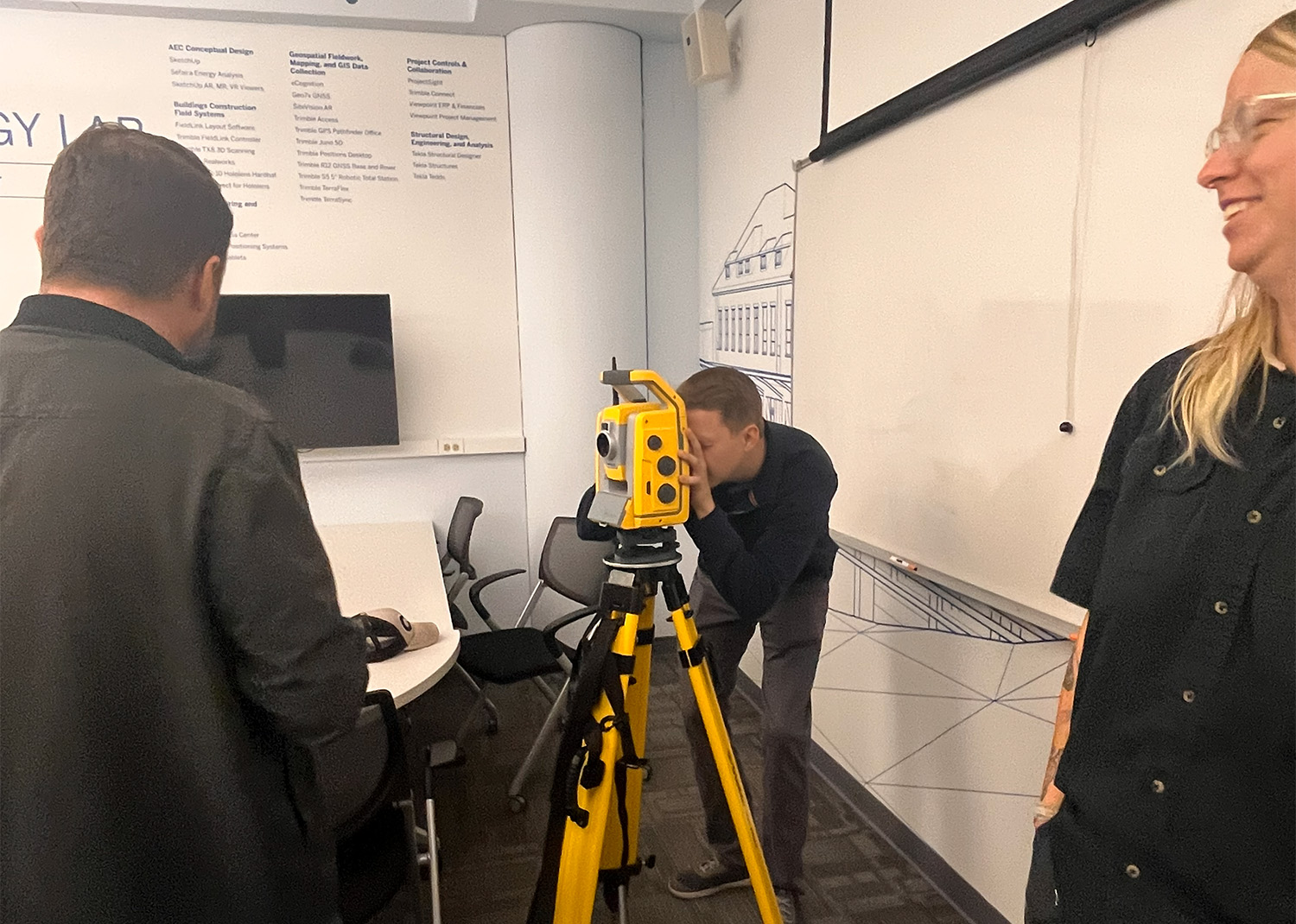
Following the presentations, students had the chance to get hands-on with technology. Under the guidance of staff and faculty, they received insight into how to operate the equipment, gaining a closer understanding of how each tool contributes to the planning, design, and construction process. This practical engagement offered a rare glimpse into day-to-day fieldwork and gave students the opportunity to picture themselves in future engineering or construction roles. 

group discussionexploring total station

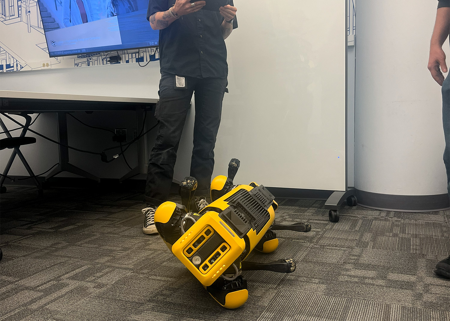
One of the most memorable moments of the day was the opportunity to drive Atlas, the school’s robotic dog, around campus. The students took turns navigating Atlas through outdoor and indoor environments, learning how robotics is increasingly used for site inspections, data capture, and safety monitoring. The tour also included visits to several additional labs, including the Outdoor Lab, which further illustrated the range of technologies and environments CU Denver students interact with throughout their studies. 

This collaboration with EPIC Campus marks an ongoing series of outreach tours aimed at engaging local Colorado high school students and strengthening the pipeline into construction and engineering programs. The Department of Civil Engineering and Construction looks forward to hosting additional campus visits in the coming months, continuing its mission to inspire the next generation of dreamers, designers, and builders. 


Meet Atlas: CU Denver’s New Robot Dog

Atlas with CU Denver

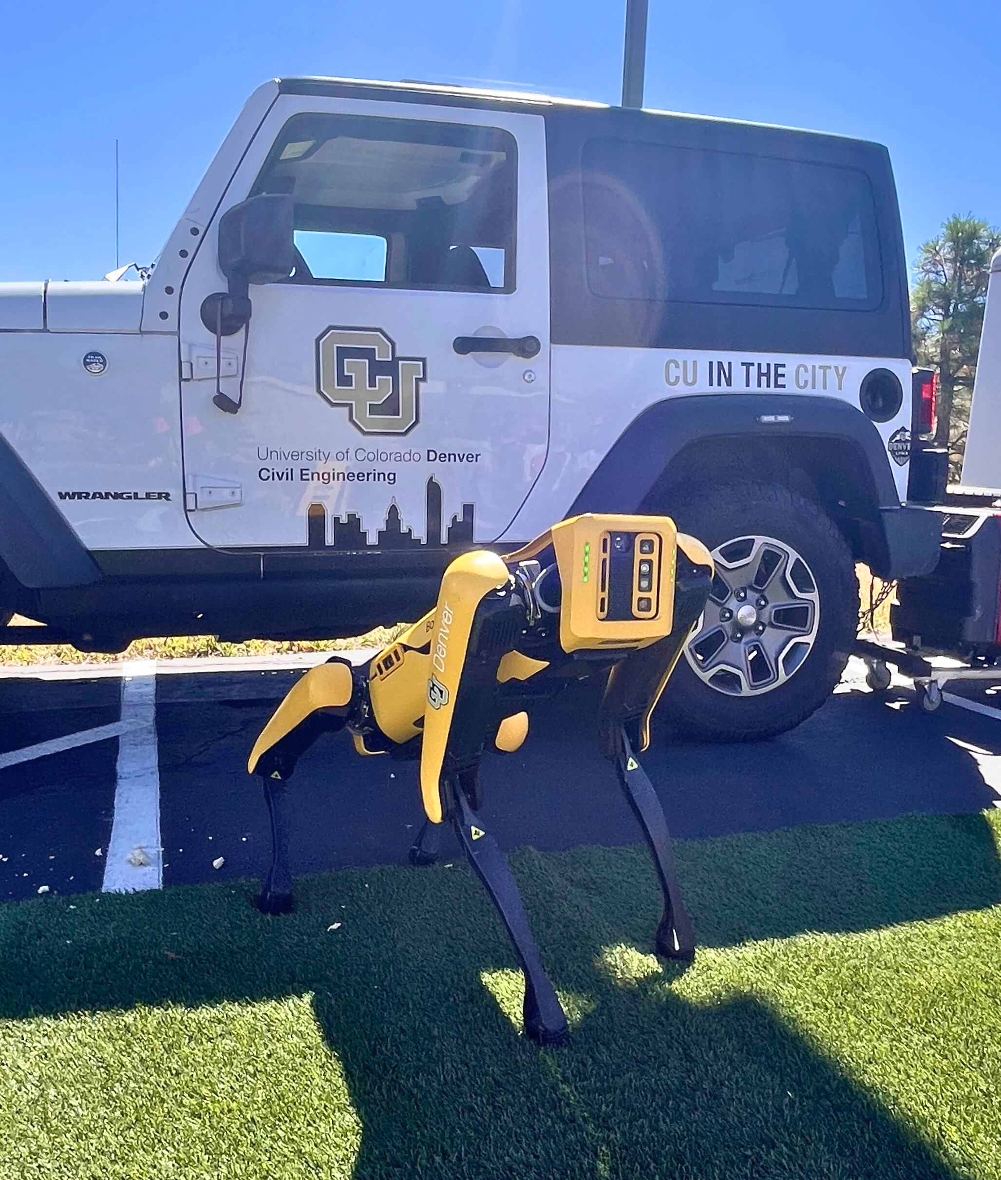
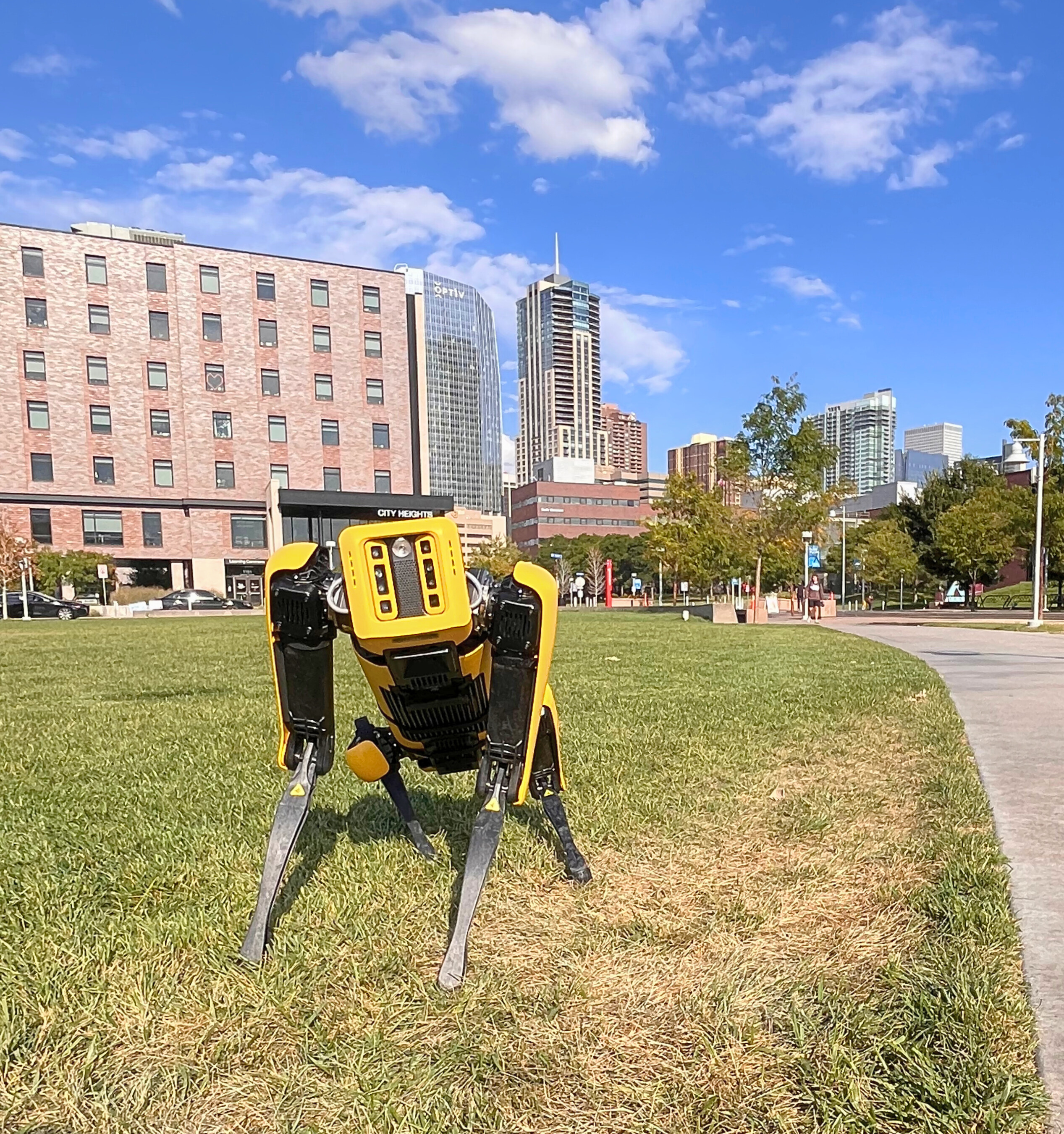
Atlas, CU Denver’s robot dog, is making waves around town. Named by CU Denver students, this robot, supported by State Grant Funding, is helping students learn about the evolving landscape in the world of Construction Technology alongside Trimble Tech. Originally designed for use in construction, manufacturing, power and utilities, mining, and other fields with areas that are too difficult or dangerous for humans to access, these robot dogs have seen numerous enhancements since their debut in 2016. Today, their capabilities include 360-degree perception, athletic intelligence, and advanced adaptability. These robots have become a valuable tool in industry and education.  

Earlier this year, the Department of Civil Engineering and Construction (CEC) acquired one of these dogs as part of their commitment to providing students with relevant experience and understanding of the technological advancements with the construction and engineering industry. Atlas’s journey started in September, when the Department hosted a Naming Event. Students, staff and faculty submitted name suggestionand voted on their favorite: Atlas. During the event, students had the chance to learn how to operate the machine, explore its applications, and even drive it. Since then, Atlas has made appearances across Colorado, including Trimble tours attended by CU Denver Chancellor Ken Christensen, CU President Todd Saliman, and Provost Karen Marrongelle. Most recently, Atlas was demonstrated for the City and County of Denver Bridge and Environmental groups.

Atlas with CarAtlas with scenario

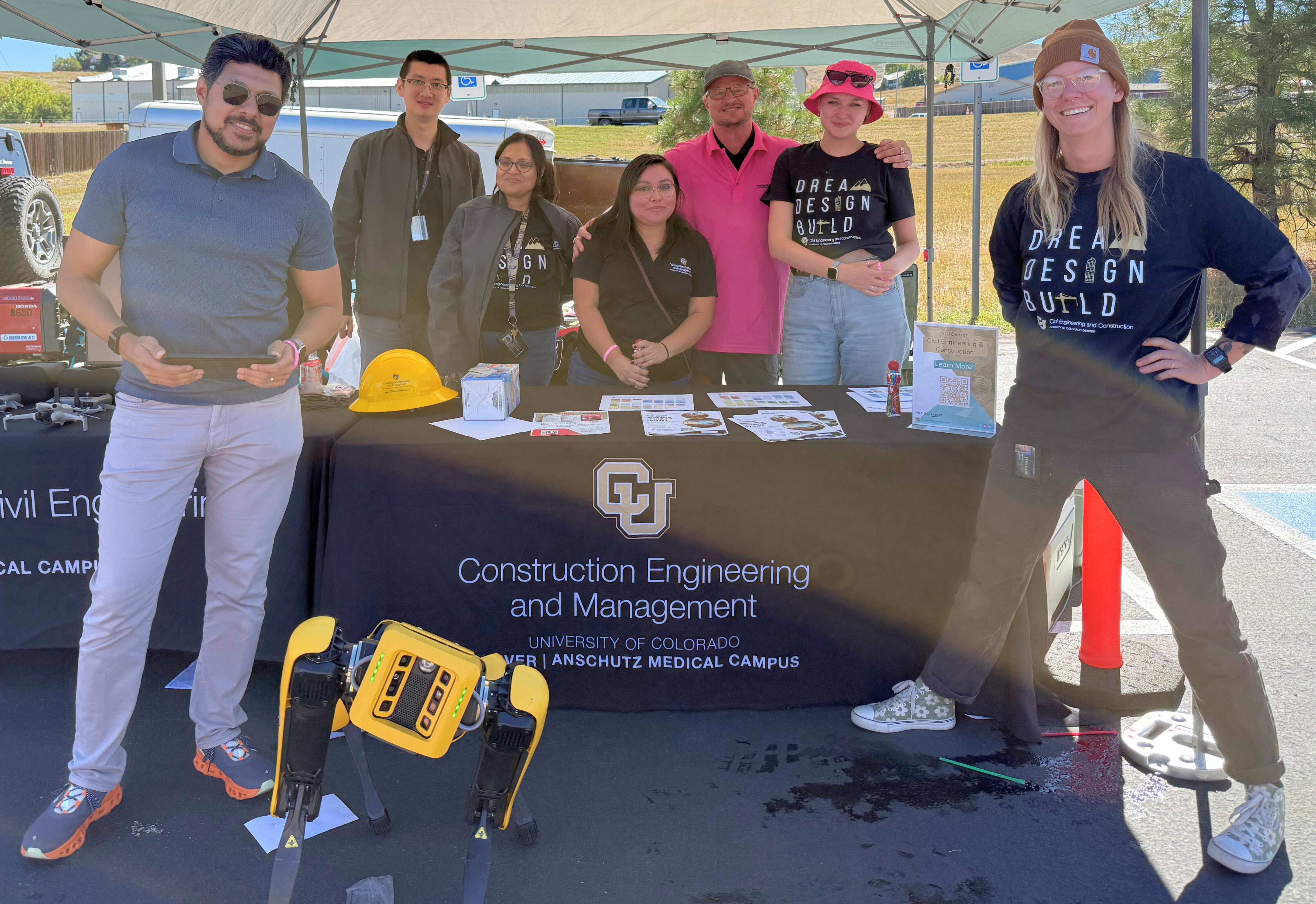
One of Atlas’s most impactful outings was the Transportation and Construction GIRL Day in Golden. This is a local organization dedicated to helping girls and young women learn more about careers and opportunities within Construction and Transportation fields. Originally created by the HOYA Foundation, (a non-profit dedicated to supporting small businesses, women, and students) the Transportation and Construction GIRL program focusses on “drawing attention to women in the transportation and construction industry and prompt others to join”. As a first-time sponsor, the CEC was invited to host an exhibit at their annual Transportation and Construction GIRL Day. Atlas was featured as an opportunity for girls to learn about the technological innovations within the industry and the type of technology offered at CU Denver in conjunction with the technologies at the Trimble Technology Lab. Staff and faculty connected with prospective students and learned more about their aspirations and shared opportunities available.

Atlas Group Photo

Looking ahead, Atlas will be integrated into CU Denver’s Technology Innovation in Construction courses, which include Building Information Modeling, Construction Surveying, and Construction Technology. These classes utilize many Trimble Technologies including surveying equipment, AR/VR tools, laser scanners, and modeling software, with the goal of preparing students for the evolving technological industry advancements. The school looks forward to developing these technologies for use with Atlas as a tool for usability, just as it would be used in the field. 

The Trimble Technology Lab at CU Denver is more than just a collection of tools—it’s a hub for experiential learning, innovation, and career readiness. By embedding advanced technologies into the curriculum, CU Denver empowers students to lead in a rapidly changing construction landscape. 


Efforts in Historical Preservation

Students at CU Denver Use Trimble Tech in Historical Preservation Efforts

Saint Leander's School Old

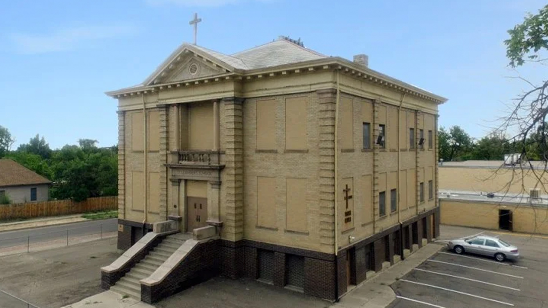
On May 13th, 2025, six CU Denver engineering students submitted a comprehensive report to a representative for Colorado Preservation Inc. containing a detailed structural analysis of Saint Leander’s School in Pueblo, CO. The team began work in January, conducting research and visiting the property to gain a deeper understanding of the building’s history, architectural style, and structure materials. Their goal was to determine what modifications would be necessary to preserve and potentially reopen the structure for community use. The most valuable part of their analysis took place in February and March when the team used a Trimble TX8 Laser Scanner from the Trimble Technology Lab at CU Denver.

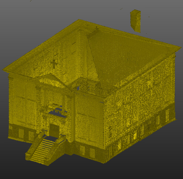
Using this technology, the students generated multiple laser scans of the interior and exterior of the school, which provided them with an in-depth view of the structural integrity and how over time the building may have shifted. These scans were fundamental in allowing the students to provide a clear idea as to what would be needed for the city of Pueblo to re-open the doors to Saint Leander’s School. When asked what he was the biggest challenge of this project, team member Austin Astrike explained that “the structure was built in 1914 so there were no as built drawings...we used the Trimble TX8 to create all of our dimensions of the exterior, which was crucial in determining if there was some deviation the settlement of the building.”

Saint Leander's School Newscan of saint leander's

This project offered these six UCD students valuable hands-on experience in construction and civil engineering. Austin highlighted how this project helped him in his job search after graduation. “During my interviews one of the questions that many employers had was about structural rehabilitation. The Trimble TX8 was very valuable in evaluating an older structure and is being used in industry even more every day.” he explained. He also noted that his exposure to field tools such as the TX8 helped him stand out during interviews.

But why St. Leander's? Why try to rehabilitate a building that is over 100 years old? The school and church have a deep-rooted history for the City of Pueblo. Originally built in 1914 as a cornerstone for the local Catholic community, the school was designated a historical landmark by the City of Pueblo in 2010. Unfortunately, since the early 70s it has primarily served as a storage facility. However, the city is interested in reopening its doors as a community space, while preserving its historical significance. “What we hoped to provide was ideas on how they (the city) could use the school to bring back a sense of community pride.”

Thanks to this Trimble Technology Lab at CU Denver, these students as well were able to “Meet their Moment” as future engineers by applying classroom knowledge to real-world industry work. This invaluable experience is another way CU students can graduate feeling ready and prepared to enter the industry with hands-on experience.

Students Mounting TX8 on Tripod    Student group photo


College of Engineering, Design and Computing

CU Denver

North Classroom

1200 Larimer Street

Suite 3034

Denver, CO 80204


303-315-7170

CMS Login